How to intercept the desired area in arcgis
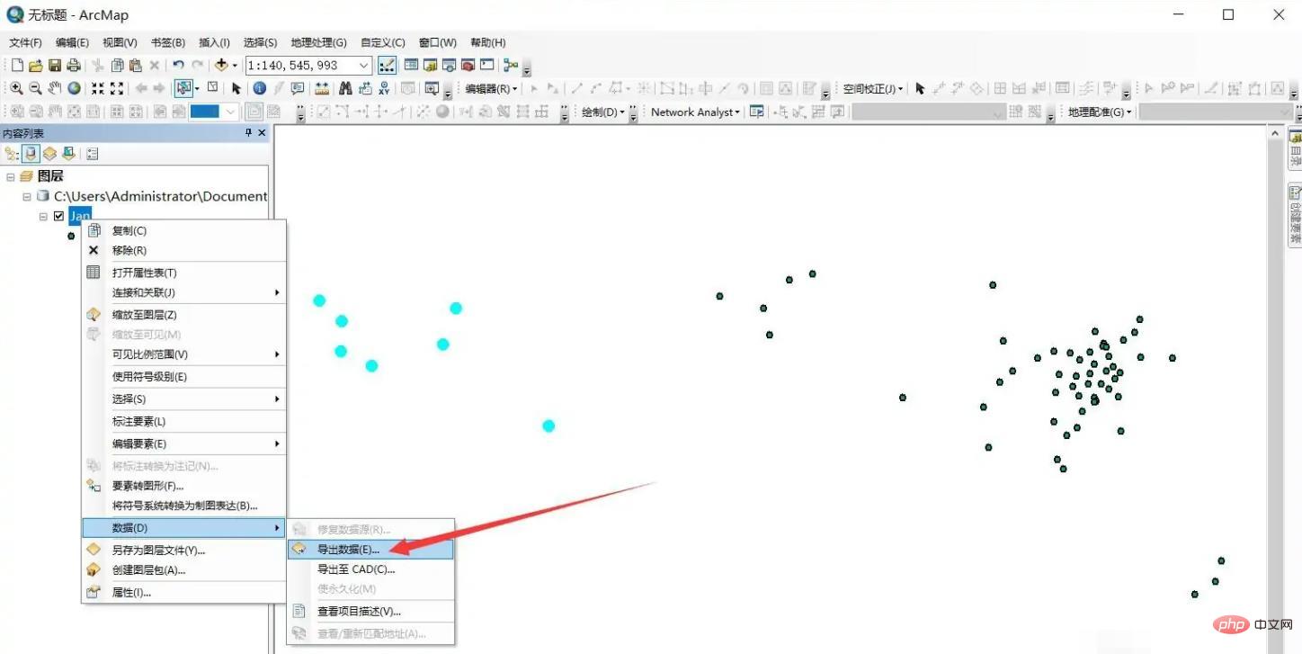
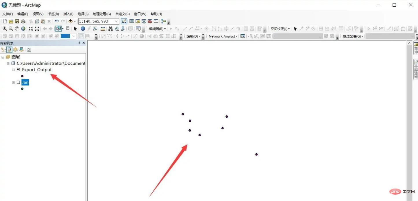
How to intercept the desired area in arcgis: 1. Open the arcgis software and click Add Data to load the layer data; 2. Click "Select-> Select by Rectangle" in the shortcut toolbar; 3. Use the rectangle Frame the area to be intercepted; 4. Right-click on the layer and select "Data->Export Data" to export the selected elements; 5. Load the intercepted elements into the view.

The operating environment of this tutorial: Windows 10 system, Dell G3 computer.
How to intercept the desired area with arcgis?
Open arcgis software and click Add Data to load layer data.

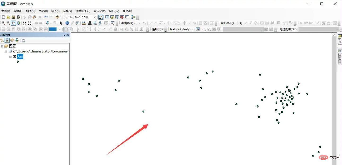
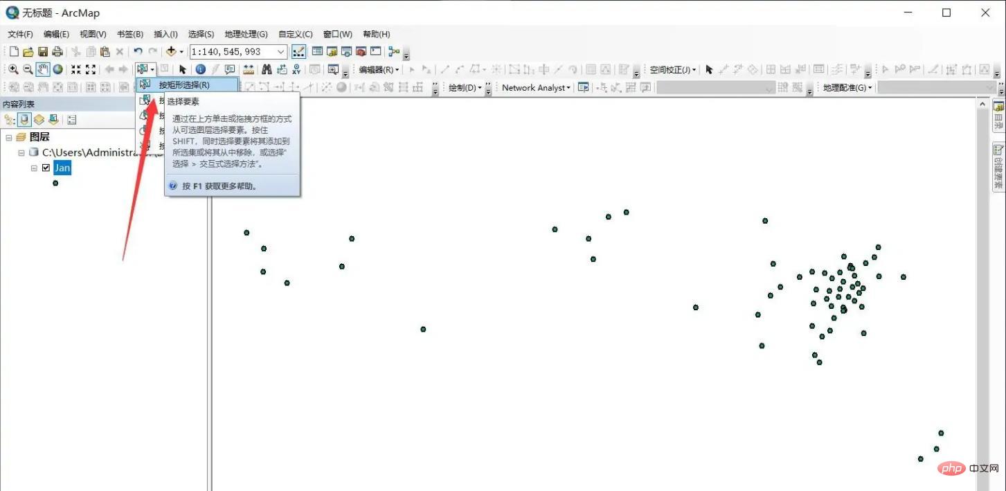
Click [Select]-[Select by Rectangle] in the shortcut toolbar.
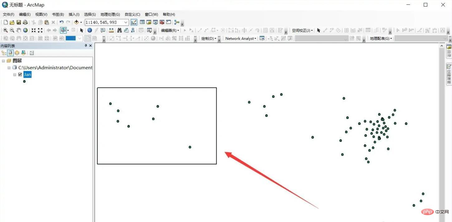
#Select the area to be intercepted through a rectangular frame, and the target elements will be highlighted.
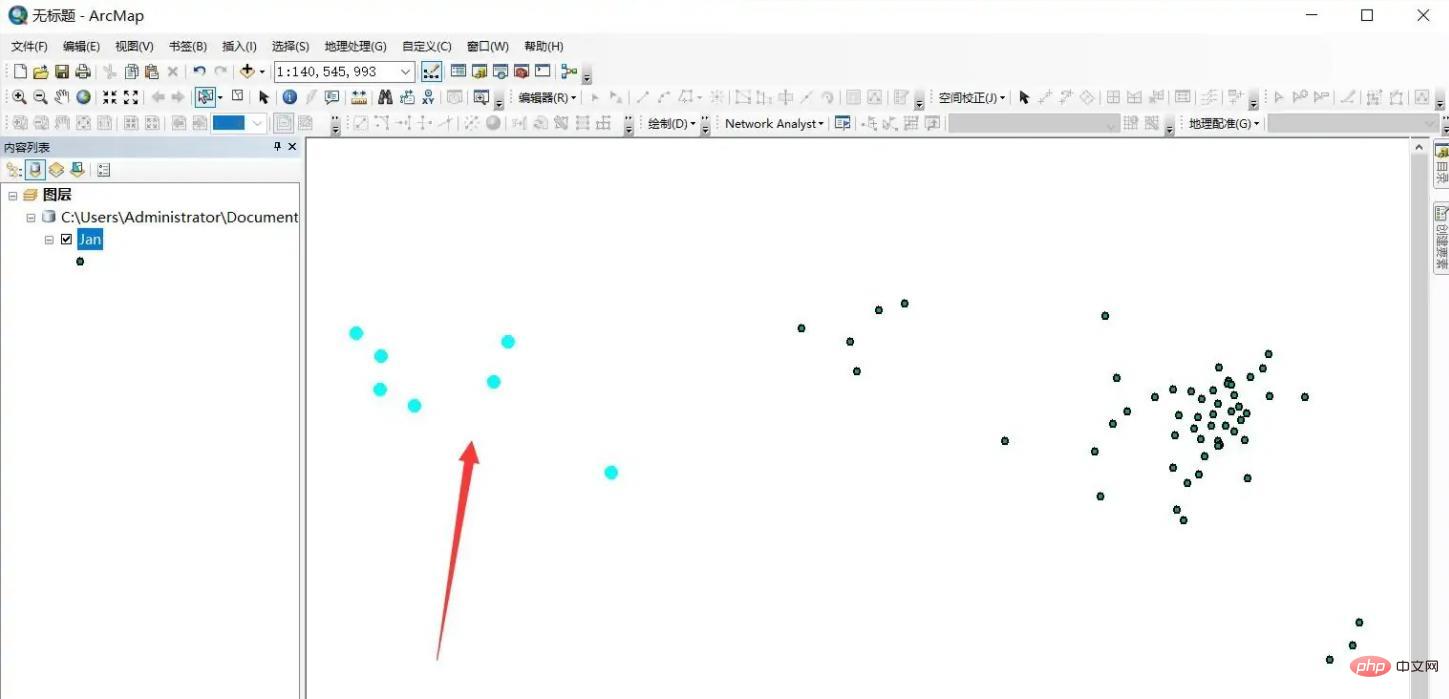
Right-click on the layer and select -[Data]-[Export Data] to export the selected elements.
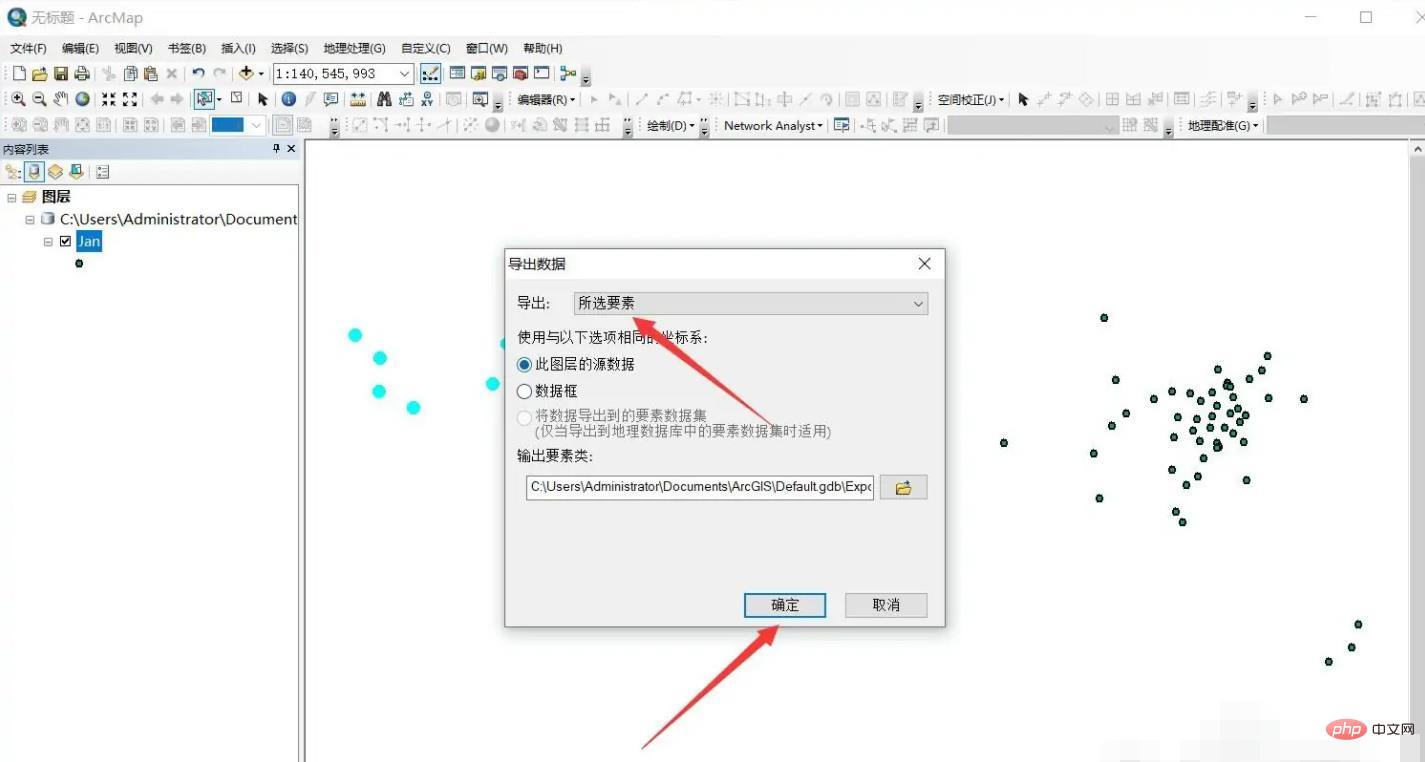
Load the intercepted elements into the view.
For more related knowledge, please visit the FAQ column!
The above is the detailed content of How to intercept the desired area in arcgis. For more information, please follow other related articles on the PHP Chinese website!

Hot AI Tools

Undresser.AI Undress
AI-powered app for creating realistic nude photos

AI Clothes Remover
Online AI tool for removing clothes from photos.

Undress AI Tool
Undress images for free

Clothoff.io
AI clothes remover

Video Face Swap
Swap faces in any video effortlessly with our completely free AI face swap tool!

Hot Article

Hot Tools

Notepad++7.3.1
Easy-to-use and free code editor

SublimeText3 Chinese version
Chinese version, very easy to use

Zend Studio 13.0.1
Powerful PHP integrated development environment

Dreamweaver CS6
Visual web development tools

SublimeText3 Mac version
God-level code editing software (SublimeText3)

Hot Topics
 1667
1667
 14
14
 1426
1426
 52
52
 1328
1328
 25
25
 1273
1273
 29
29
 1255
1255
 24
24


